Hel Peninsula Is Not an Island, and That Changes How You Should Visit
I got this wrong myself the first time I looked at a map of the Gdańsk coast. There’s a thin curl of land hooking out into the sea north of the city, and it reads, at a glance, exactly like an island - something cut off, something you’d need a proper crossing for. It isn’t. Hel is a peninsula, a sand spit about 35 kilometres long, and in places barely 200 metres wide, tacked onto the mainland near a small town called Władysławowo. You can, if you want, drive there without ever touching a boat. But the confusion is understandable, and more than that, I think it’s useful - because the very thing that makes Hel look like an island on a map is the same thing that shapes almost everything you’ll actually do there.
A sand spit, not a landmass
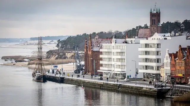
Picture a comma of sand drawn off the coastline, curving out into Gdańsk Bay and then hooking back toward the mainland at its tip, where the town of Hel itself sits. That’s the shape. At its narrowest point, you could stand on the beach on one side and see, and sometimes practically shout across to, the water on the other. It’s this narrowness, not any actual separation from the mainland, that gives Hel its island-like silhouette.
Geologically it’s a barrier spit, built up over centuries by longshore drift depositing sand along the coast, the same slow process that built the dunes further along at Łeba, just further along the coast and considerably wilder. Hel’s version is tamer, settled, threaded with a road and a rail line, but it’s made of the same basic material and the same basic process.
Because it’s a spit and not an island, Hel has two very different coastlines running in parallel for its entire length, sometimes only a few hundred metres apart. On one side: the open Baltic, facing north, exposed to real swell and wind off the sea. On the other: Puck Bay, sheltered, shallow, and almost lake-calm by comparison. I don’t think I appreciated how strange that juxtaposition is until I stood near Jastarnia and realised I could walk five minutes in one direction to open sea, or five minutes in the other to water so tame it barely had a ripple. Most peninsulas don’t offer you that choice within a single short walk. Hel does, because it’s so absurdly narrow for most of its length.
Why that shape decides how you get there
If Hel were a true island, you’d need a ferry or nothing. Because it’s attached, you actually get three realistic ways in, and the choice matters more than people expect.
The most straightforward is the direct summer train from Gdańsk Glowny, which takes around two hours and drops you close to the centre of Hel town - simple, scenic along stretches, and immune to traffic. Driving is the second option, and it works, since a single road runs the peninsula’s length, but in July and August that road becomes a genuine bottleneck: a narrow strip of land with one route in and one route out, filled with day-trippers doing exactly what you’re doing.
I’d treat a summer drive to Hel less as a scenic outing and more as a queue with sea views. The third option is the seasonal passenger boat from Gdańsk, Sopot or Gdynia, roughly 90 minutes to two hours depending on the route and the weather - genuinely pleasant when conditions cooperate, genuinely unpleasant when they don’t, since it’s crossing open bay water rather than a sheltered channel. None of these are wrong, but knowing you have a landward option at all is the part people miss when they assume Hel needs a ferry the way, say, a true offshore island would.
The Fokarium exists because of this geography
Hel town, right at the peninsula’s tip, is home to the Fokarium - the seal sanctuary run by the University of Gdańsk’s Marine Station, with feeding talks several times a day depending on the season. It’s easy to see it as just another animal attraction, but its location isn’t incidental. The Baltic grey seal population that the station works to protect and reintroduce depends on exactly this kind of sheltered, low-disturbance coastal pocket, the sort of habitat a narrow, semi-enclosed peninsula tip provides. I found the feeding sessions worth timing a visit around rather than hoping to catch by luck; they’re not constant, and arriving between sessions means a lot of waiting for not much to see.
Two bays, two very different uses
Here’s where the shape really earns its keep. Jastarnia and Puck, both sitting on the bay side rather than the open-sea side, have become two of the region’s best-known spots for kitesurfing and windsurfing rather than conventional beach resorts. That’s not an accident of branding - it’s the water. Puck Bay is shallow, often barely chest-deep a long way out, and it catches wind reliably because the peninsula itself funnels and amplifies airflow along its length.
Shallow, wind-exposed, relatively flat water is close to ideal for kite and board sports and genuinely poor for the kind of swimming-and-sunbathing beach day you’d get on the open Baltic side near Jastarnia’s own outer shore or further along the coast. So the bay towns lean hard into watersports schools and rental outfits instead of trying to be another stretch of Baltic swimming beach, and once you understand the geography, that specialisation stops looking like a quirk and starts looking obvious.
Getting the shape right before you plan
None of this is really about correcting a map error for its own sake. It’s that treating Hel as an island versus understanding it as a peninsula changes real decisions: whether you need to plan around a ferry timetable or can simply catch a train, whether a summer drive is a sensible idea or a mistake, and why Jastarnia and Puck feel so different in character from Hel town itself despite sitting on the same strip of land. A narrow sand spit between an open sea and a sheltered bay isn’t a lesser version of an island - it’s a different kind of place entirely, with a beach on either hand and two personalities within walking distance of each other.
If you’re weighing a visit, it’s worth reading a fuller fast boat crossing on Gdańsk Bay against the summer train and the road option before committing, since the crossing itself becomes part of the day rather than a chore to get through.
A slower, more scenic alternative is a breakfast cruise by catamaran from Gdańsk or Sopot, which won’t get you all the way to Hel but gives a good sense of the bay Hel encloses. And if the geography of the wider region interests you as much as it did me, a private city tour of Gdańsk is a good way to have someone map out how the coast, the bay and the peninsula fit together before you head out on your own.
For planning the trip itself, our Hel Peninsula day trip guide and guide to the boat crossing go through timings in more detail, and the Fokarium seal sanctuary guide covers feeding times. If watersports are more your interest than sightseeing, see our notes on kitesurfing at Puck Bay and Jastarnia and the wider Baltic coast watersports guide.
For the towns themselves, our Hel Peninsula destination page, Jastarnia page and Puck page have the practical details, and Gdynia and Sopot are the two most common departure points for the seasonal boat.
If you’re deciding whether a car makes sense at all, our piece on whether you should rent a car in Gdańsk and our guide to getting around the Tricity are worth reading first, and a Sopot and Hel beach weekend itinerary lays out a full two-day version of this trip. Finally, if you’re curious what else along this coast gets misread the way Hel does, our piece on the city of Gdańsk itself and how it differs from the wider Tricity is a good next stop.
tours.Explainer
Verified deep-linked GetYourGuide tours. Book through these links and we earn a small commission at no cost to you.
GetYourGuide does not provide a product photo for this activity — the image shows the meeting point, photographed by us.